The port of Santander has a strategic geographical location for trade with Atlantic Europe and the rest of the world. With a latitude at Muelle de Maura of 43º 27' 39" N and a longitude of 3º 48' 10" W, its outer limit is located on the alignment between the Cabo Mayor Lighthouse (43º 29' 29" N, 3º 47' 22" W) and the Cabo Ajo Lighthouse (43º 30' 42" N, 3º 35' 12" W) up to the intersection with the meridian 3º 43' 44" W, which is that of the Santa Marina Island beacon. From the aforementioned line, the port extends 5 miles to the southwest, being its main navigation channel the one that runs along the northern shore of the Bay along the entire edge of the city of Santander, at the end of which, it turns south and continues to the town of Astillero.
-
CONNECTIONS
-
By road:
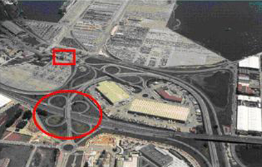
From Asturias.
By the Cantabrian highway (A-8) and the national highway N-634, called San Sebastián-Bilbao-Santander-La Coruña, which connects in Torrelavega with the N-611 Palencia-Santander highway.
From Palencia and Burgos.
By the Cantabria-Meseta highway (A-67) and the national highway N-623, linking with the Torrelavega-Santander highway.
From Bilbao.
By the Cantabrian highway (A-8). All of them are toll-free and with direct access from the port facilities.
By railroad:
Conventional width
Access to the port by conventional gauge is only through the Muriedas station.
This connects with the line from Santander to Madrid, through Valladolid and Palencia.Metric width
In metric gauge, access is through the Maliaño La Vidriera station.
It connects with the route from Santander to Bilbao and from Santander to Ferrol, passing through Oviedo and Gijón.The Raos 1, 2, 3 and 5 docks have conventional and metric gauge tracks. All terminals of the port of Santander have rail connection.
-
HINTERLAND
-
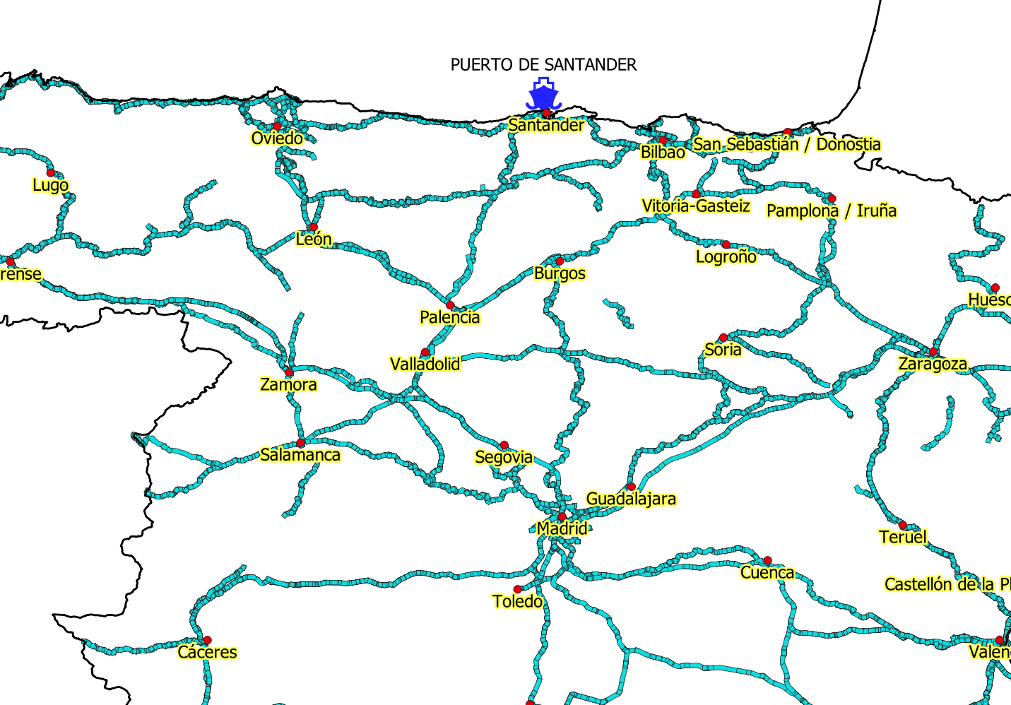
In addition to Cantabria and the bordering areas of Asturias and the Basque Country, the main axis of the hinterland of the Port of Santander has historically been Castilla y León. However, thanks to the improvement of the connections with the Meseta, mainly through the toll-free highway, the rest of the Iberian Peninsula has found in the Port of Santander and its privileged geographical location a very competitive solution for the distribution of the goods generated by its industry, shortening distances and reducing costs.
-
FORELAND
-
The internationalizing and global vocation of the Port of Santander is unquestionable and this is demonstrated by the rates of trade with countries such as the United Kingdom, France, Belgium, the Netherlands, Germany in the EU or South America such as Argentina, Venezuela or Brazil, to which we must also add the U.S. But thanks to its privileged location, Santander also finds trade relations with destinations as diverse as the Baltic States, Russia, South Africa, China or Japan. Thus, the development of this international vocation means that the connections of the Port of Santander cover the five continents and the goods that transit through its docks have origin and destination in a hundred countries.